Spatial Analysis and Visualization for Professionals
291 views1 clones
Category
DesignTags
Illustration
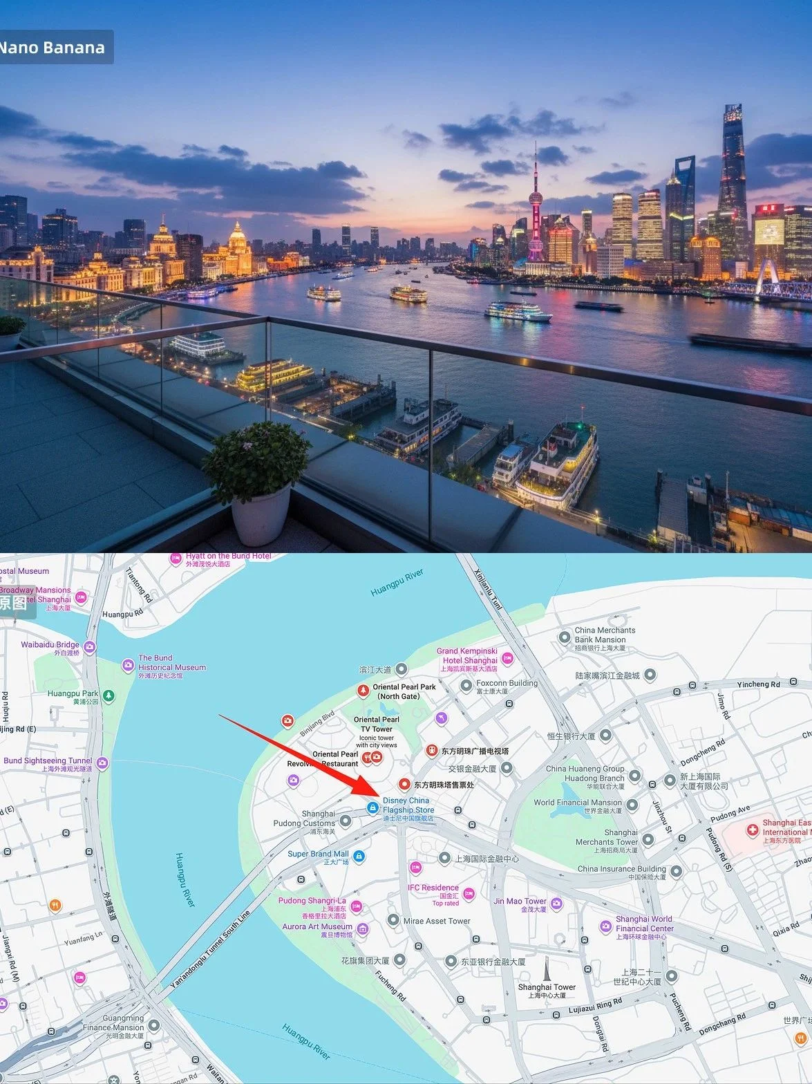
Description
It is convenient for architects, urban planners, surveyors and other professionals to convert photos to top-down views, mark observation points, and visualize scenes from specific directions, which helps in spatial analysis, design planning, and improves work efficiency.
Prompt
Convert the photo to a top-down view and mark the location of the photographer.
draw what the red arrow sees.
Generate similar images with Nano Banana Pro
Adjust the prompt below and generate high-quality images instantly
Image Generator
Select Aspect Ratio
110 / 2000
Cost 2 creditsRemaining 0 credits
Image Preview
No Images Generated